Piece by Piece, Saskatchewan’s Land is Divided
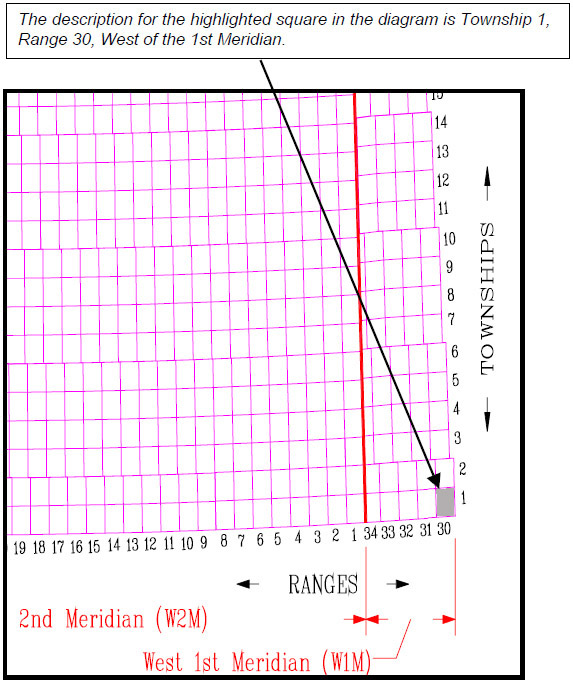
Township lines run north and south, Range lines run east and west. Their intersections create a grid of townships. Each township is further divided into sections, quarter sections and legal subdivisions. There are approximately 3,600 townships in Saskatchewan. Follow the pictures below to learn about the breakdown of the Land Survey System.
|
|
 |
One “square” on the grid is called a township, which consists of 36 squares. |
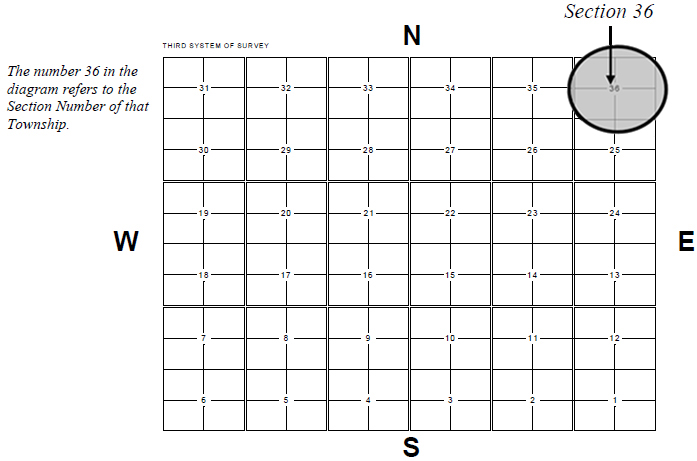 |
Each of the 36 squares are called sections that are numbered from the bottom right hand corner starting at number one and ending in the top right corner with the number thirty six. Every section contains approximately 640 acres of land and is about one square mile in size. |
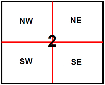 |
A section is made up of four quarter sections. The quarters in a section are described as the North East (NE), North West (NW), South East (SE) and South West (SW) quarters. Each quarter section is approximately 160 acres and is described by its compass direction, e.g. North and West = NW 1/4, South and East = SE 1/4. |
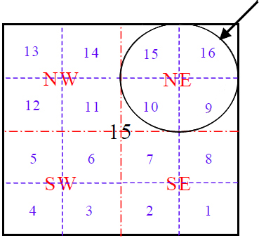 |
Each quarter section can be divided into four legal subdivisions. Therefore sixteen subdivisions in each section. They are numbered from the bottom right hand corner starting at number one and ending in the top right corner with the number 16. Each legal subdivision is approximately 40 acres in size. |
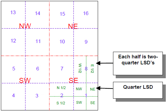 |
A legal subdivision may be divided into four equal parts called quarter legal subdivisions, which are approximately 10 acres in area. The 1st legal subdivision in the diagram has been divided into quarters. The 2nd and 8th legal subdivisions have been divided into halves (two quarters). |
Read
Western Canada's Meridians to learn how early surveyors marked out Saskatchewan's boundaries.