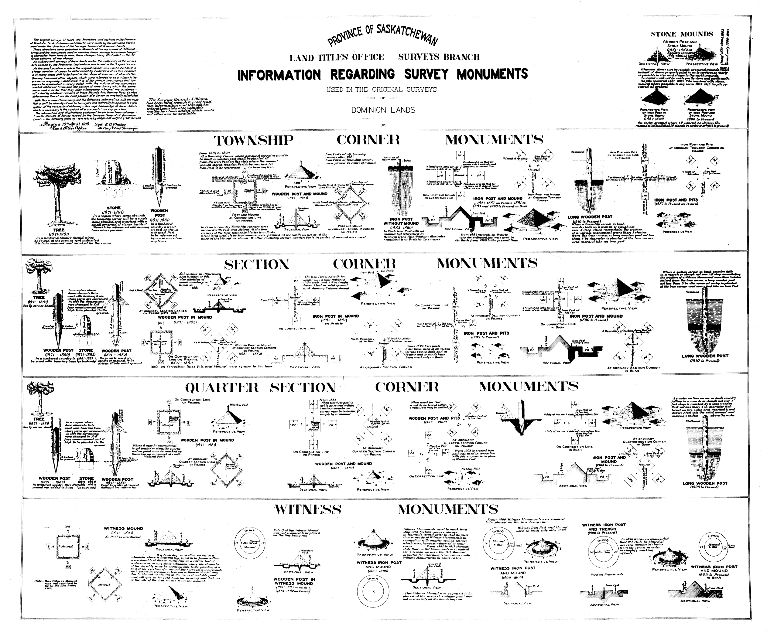
The survey monuments chart was commissioned by E.H. Phillips, an Acting Chief Surveyor in the early 1900s, and was finished in April 1915. The text in the top left corner of the chart (pictured right) is an introduction written by Phillips and it explains why he commissioned the chart:
“The original surveys of lands into Townships and sections in the province[s] of Manitoba, Saskatchewan and Alberta were made by the Dominion Government under the direction of the Surveyor General of Dominion lands. These directions were embodied in Manuals of Survey issued at different times and the monuments used in marking these surveys have been changed in character from time to time, these changes being illustrated in the different editions of the manual.
All subsequent surveys of these lands under the authority of the various acts passed by the Provincial Legislature are based on the Original Surveys. As the exact position in which the original corner was established must in a large number of cases be determined by evidence and as the evidence in many cases still to be found in the shape of remains of Mounds, Pits, Bearing Trees and other objects which were intended to be witness to the corner as originally established, it is of the utmost importance that surveyors be acquainted in every detail with the nature of the monuments used at different times and the periods of time during which the same were used in order that they may intelligently interpret the evidence afforded by whatever remains of those Mounds, Pits, Bearing Trees & when determining therefrom the exact position of a corner as originally established.
With this in view I have compiled the following information with the hope that it will be directly of use to Surveyors and indirectly bring them to a realization of the necessity of obtaining a thorough knowledge of these details which is necessary to the conduct of a successful survey practice. The information and illustrations contained herein have been obtained from the Manuals of Survey issued by the Surveyor General of Dominion Lands…”