The Parcel section provides information directly related to the parcel itself, including the parcel number, type, status, class, total units, value, and land description.
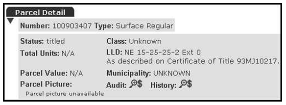
Three additional options are available to you from within this section. They are as follows: parcel picture, parcel audit, and parcel history.
Parcel Picture
You can access this option by selecting the View Image icon located next to the Parcel Picture heading.
NOTE: If no View Image icon displays next to the Parcel Picture heading, the picture is not available. Please see our
Parcel Picture on Demand service to see how you can request this parcel picture.
Parcel Picture allows you to view a Geographic Information System (GIS) picture of the parcel that you are currently examining. This option is useful when trying to confirm that this parcel is indeed the one that you are trying to locate. It will provide you with a visual confirmation as well as other useful visual information related to the parcel in question. This can be a valuable tool in title and abstract verification.
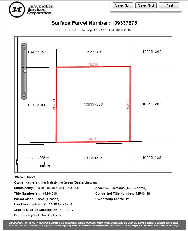
NOTES:
- The acreage displayed in parcel picture will be based on GIS calculations and not on the acreage as shown on cancelled paper titles. Acreage information will only be available where the parcel picture is available
- The View Image icon links to a picture of the parcel of land to which the title or abstract you are searching refers. The picture is not a plan of survey. It is only an approximate representation of parcel boundaries, dimensions, and area. To determine the actual boundaries, dimensions, or area of any parcel, refer to The Land Surveys Act 2000. This parcel picture should not be relied upon for any purpose whatsoever.
Parcel Audit
You can access this option by selecting the Examine icon located next to the Audit heading. Parcel Audit displays all transactions that have occurred in relation to a specific parcel since conversion to the LAND System. It provides the date and action/application, as well as any details pertaining to these transactions. This is useful when tracking the changes that have occurred to a parcel over its lifetime.
Parcel History
You can access this option by selecting the Examine icon located next to the History heading. Parcel history indicates whether the parcel has been transformed (i.e., since conversion to the current online Land Registry system).