The Map Search interface will display various levels of detailed spatial information, depending on how far you zoom in or out of the map. Different map layers (e.g., roads, parks, water bodies) may also be turned on or off to create customized map views. You can also identify items on the map that link directly to a title, plan, or other land-related record that is related to your selected parcels.
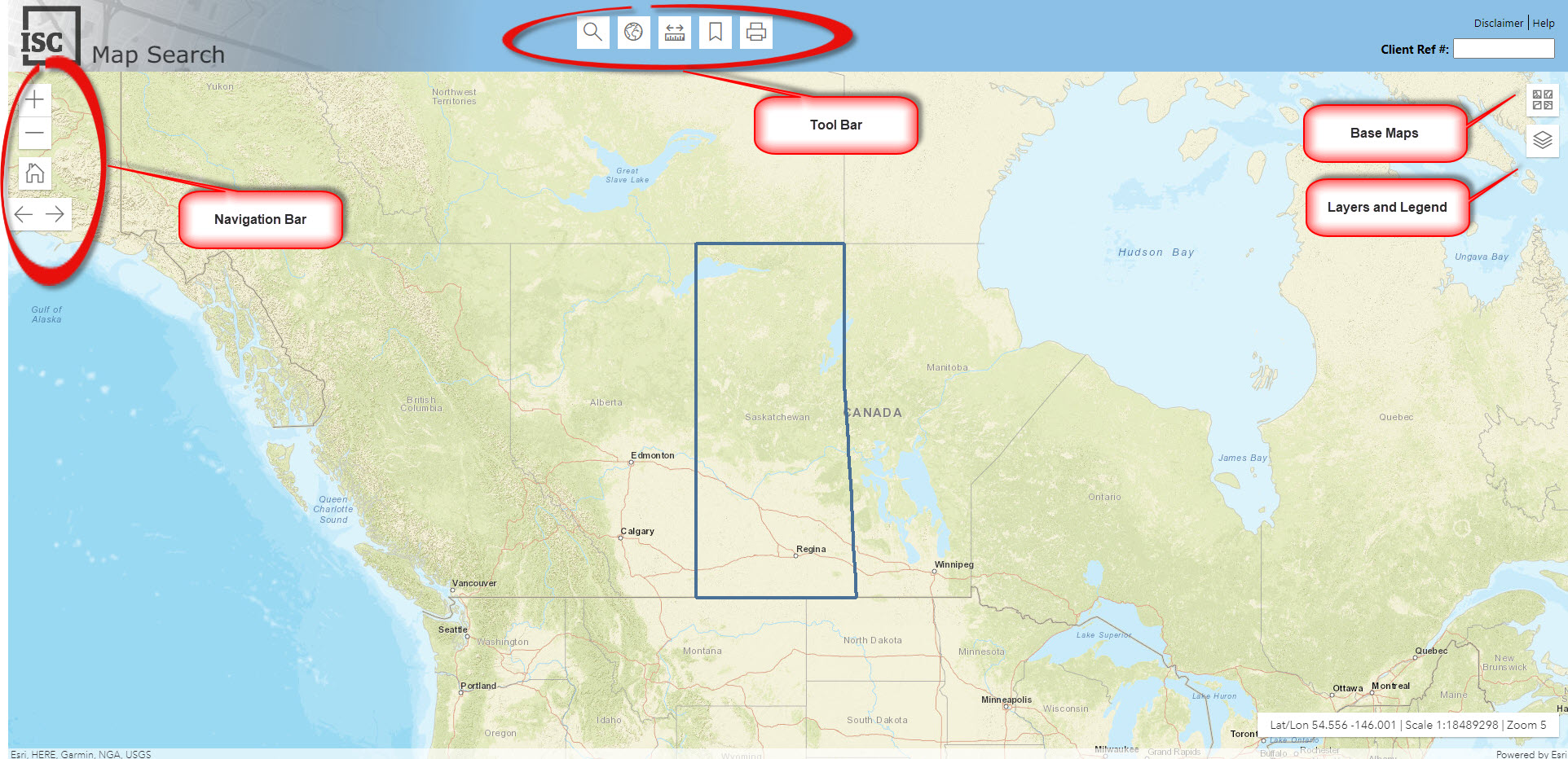
The Map Search interface is user-friendly with a clean and simple navigation design. A five button toolbar helps even the most novice user find the title and plan information they are are looking for, with minimal effort.
The simple five button
Toolbar provides access to all the tools you'll need to find title and plan information anywhere in Saskatchewan. You can hover over the Toolbar icons to see their specific descriptions. The individual tools in the toolbar include:
Here you can view all layers that are used in Map Search.
- Check out the Map Layer Descriptions section for a complete list of map layers and layer descriptions.
- Certain layers are only visible at specific scales. Check out the Layers section for more information about which layers are visible at what map scales.
Base maps help make the map more meaningful and help you orient yourself to find exactly what you are looking for, as quickly as possible. Some examples of the base maps used in Map Search include streets, imagery and more.
*Please note that base maps are for reference purposes only.
You now get more information when and where you need it.
Useful Things to Know:
Map layers composed of lines, such as roads and railways, overlay quite easily. Layers which are based on polygons that cover the map, however, can only be viewed one at a time. For this reason, a map layer may be 'hidden', i.e. the layer might be turned on, but you won't be able to see it. By convention, Map Search draws layers at the bottom of the legend first. If a layer seems hidden, turn off the layers above it to make it visible.